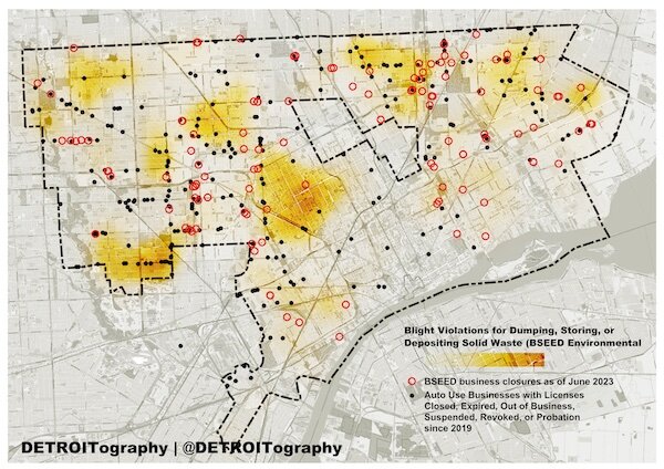
Mapping Detroit: Fact-checking the mayor’s claims on Detroit’s scrap yard tally
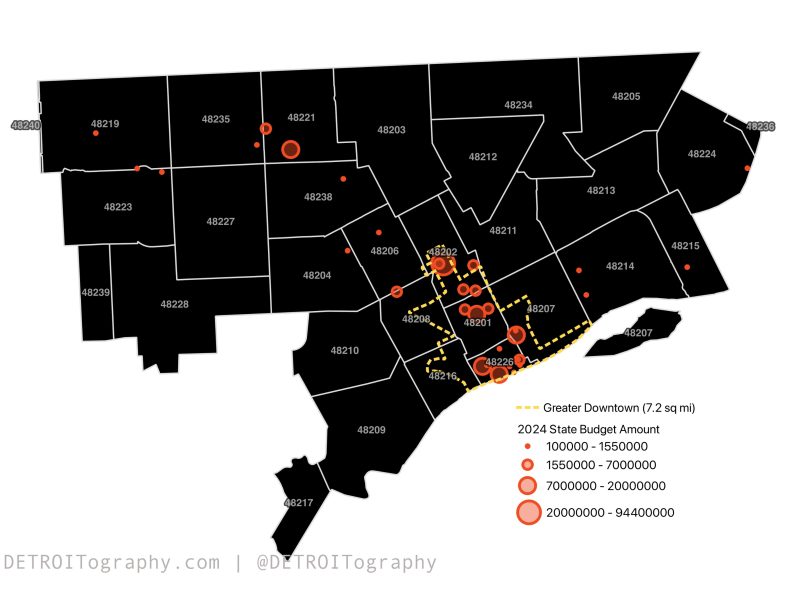
Data is a valuable commodity and it’s unfortunate when it’s used in unverifiable or confusing ways. When the City publicly references data, it should be readily available on the city’s open data portal or another public source.